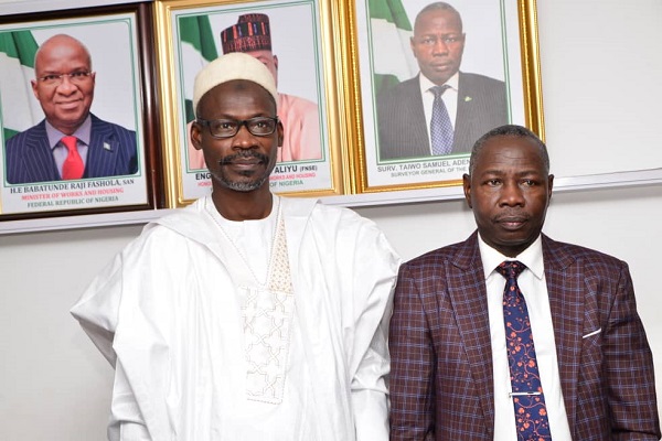
The director-general of the National Space Research and Development Agency (NASRDA), Dr. Halilu Shaba, has called for partnership among agencies of government with common goals and vision for sustainable national development.
He made the call when he led a delegation of top management staff of the agency on a courtesy call on the Office of the Surveyor General of the Federation (OSGOF) in Abuja.
He highlighted that both agencies of government had always had a good working relationship that should transform into a formidable alliance which would facilitate the exchange of relevant information to aid effective policy formulation and implementation.
Shaba pointed out that the fact that the space agency generates satellite data while OSGOF is a repository of geospatial data underscored the need for building and sustaining the bridge between both institutions to achieve greater results for national development.
The NASRDA boss called on stakeholders and other relevant agencies to take advantage of the Geo-Referenced Infrastructure and Demographic data for Development, GRID3 programme which according to him is aimed at increasing access to geospatial data for use by decision makers at all levels of government.
He commended the management staff of OSGOF for their role in sustaining the relationship with the space agency as well as the expertise employed in ensuring proper mapping of strategic locations especially areas that are considered inaccessible.
In his response, the Surveyor- General of the Federation (SGF), Taiwo Adeniran, said the two organisations were meant to complement each other in the exchange of relevant data for strategic planning and decision making.
He emphasised the need to strengthen the existing collaboration with space agency which according to him will play a very significant role in identifying key government priorities and mapping out strategies on how to actualise a result-oriented impact for the overall benefits of Nigerians.
Adeniran pointed out that the mandate of OSGOF is to be the national authority in surveying and mapping by providing in the most cost effective way, readily available maps and geographic information of the country for sustainable national development and security.
He appealed to the space agency to ensure the continuous supply of high-resolution imageries through the deployment of space technology that would go a long way in providing solutions to the challenges confronted by OSGOF in the course of discharging its constitutional functions in line with international best practices.

